


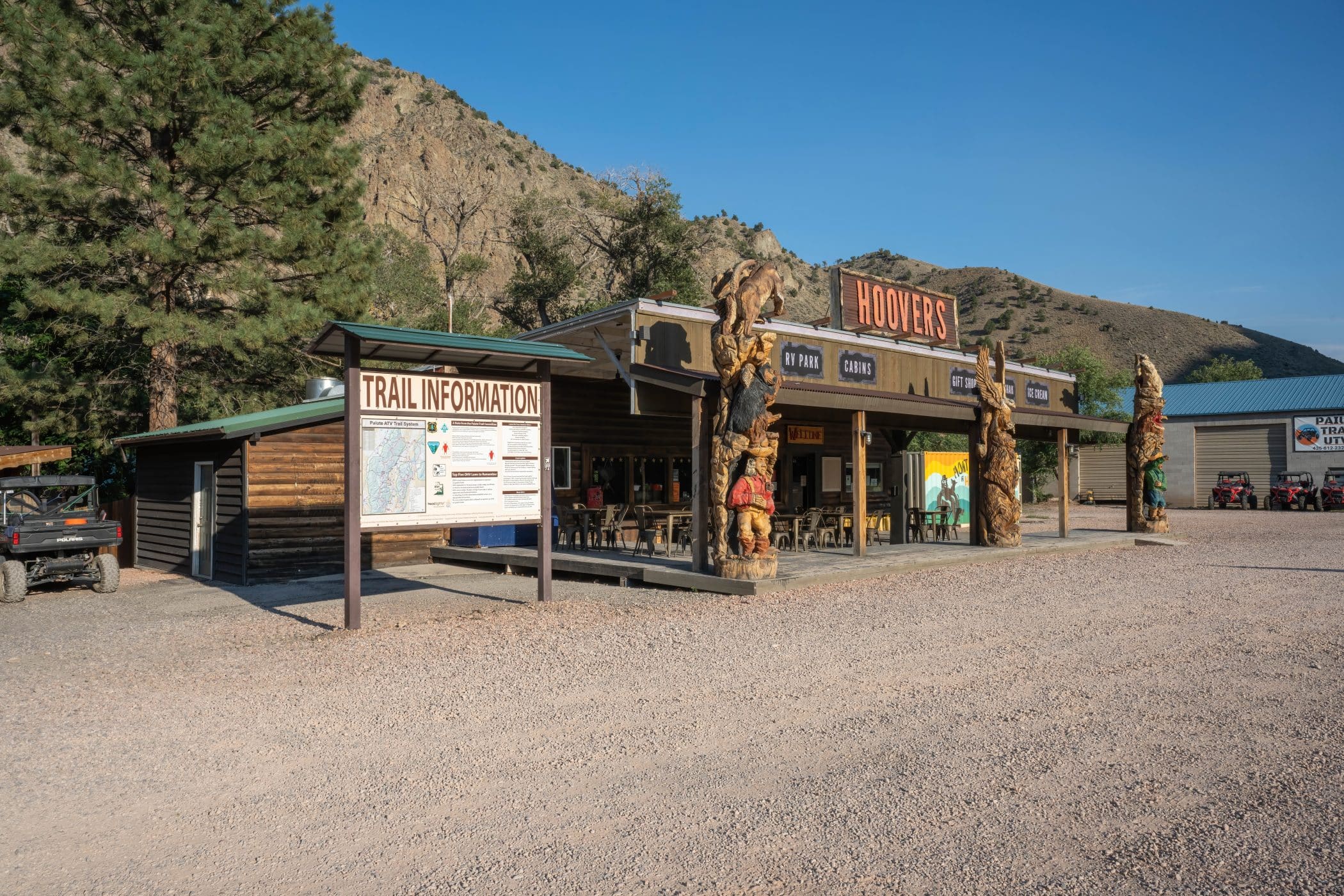
Hoovers’ Reststop Trailhead
This trailhead is located on Highway 89, 1 mile south of Big Rock Candy Mountain and 5 miles north of Marysvale. It is referred to as the Hoovers’ Trailhead because it is directly across Highway 89 due west from Hoovers, which has been a popular way stop on Highway 89 for more than 75 years.
Hoovers is actually a Utah Highway Reststop with nice, well-maintained restrooms, drinking water, and picnic tables. There is room to park and unload at this location, so consider having lunch here if Hoovers and Big Rock Cafe are open. Beyond these establishments, you’ll need to come with your own provisions.
While this trailhead provides access to Hoovers, Big Rock Candy Mountain, and connections south to Marysvale and north to Joseph and Monroe, it mainly serves the very popular PST #74, aka the Deer Creek Trail.
The Deer Creek Trail (PST #74) is open to vehicles of all sizes. The lower portion (first 2 miles) is a road used by full-sized vehicles. The upper portion is more trail, and full-sized passenger vehicles are not recommended.
The trail has a more difficult rating and needs some skill and attention. There are a few steep and rough segments that will have passengers grabbing the “oh shit” bar.
The first mile of this route has had development around it in recent years, so watch your speed, keep the dust down, wave, and be courteous and friendly. It’s important to be a good neighbor.
Hoovers’ Reststop Trailhead
EXAMPLE GPS Coordinates: 41°24’12.2″N 2°10’26.5″E

After the first stream crossing, the trail becomes steep and rough. At the 2.5-mile mark, you’ll see slow, children at play signs because the trail passes through private property where there are two cabins right next to the creek and the trail. It’s only for a quarter mile, but again, keep your speed under 5 miles per hour and reduce dust and noise for these residents.
As you ride on, the lush vegetation of the stream bottom helps to cool the summer air, and the forest canopy that closes riders into a tunnel of shade and shadow is pure delight. Despite this, the upper end of this trail has some steep and rough spots that demand your attention.
Remember to use hand signals as there is a high chance you’ll meet other machines and riders. Note, the traffic travels in both directions, so pass with care. A closed fist means you are a lone rider with no one behind you. If your riding buddy is behind you, then it’s one finger extended, telling the oncoming unit there is one more rider behind you. Two fingers if there are two more riders, and so on.
Though Deer Creek Trail only runs for eight miles before meeting up with Paiute #01, it is often considered the prettiest eight miles on the Paiute system.
Once you complete the Deer Creek Trail, it’s decision time. At the conjunction of the two trails, you’ll find picnic tables you can use for a snack and to make a plan.
You can go north (right) on the main Paiute and pay a visit to the Silver King Mine historical site, which is just 1.3 miles away and has a restroom. Continuing from there, you can access the Max Reid Trail, Fremont Indian State Park, Kimberly, and many points of interest to the north.
If you go south (left) on Paiute #01, it’s 1.5 miles from Deer Creek to Beaver Creek and the Paiute and PST #02 junction. There, you can either go back to Marysvale (9 miles) or continue on Paiute #01 to the Tushar Summit (7 miles) where the trail crosses over the Tushar range at an elevation of 11,450’ (the highest point on the Paiute #01 trail). Enjoy the views above timberline, look for mountain goats, and find out for yourself that the sky is bigger at the top of the mountain.