Aurora Trailhead
0 Comments
The little community of Aurora on the north end of the Paiute Trail System has two nice trailheads for visitor use—one on the east side of town and one on the west side adjacent to Highway 89....


The little community of Aurora on the north end of the Paiute Trail System has two nice trailheads for visitor use—one on the east side of town and one on the west side adjacent to Highway 89....

Cove Fort is another great access point for getting on the Paiute Trail on the west side of the trail system where you'll enjoy easy access from I-15....

The Monroe trailhead is located at the south end of Main Street next to the EMS building. This trailhead is very popular as you can leave in several directions with either big or small machines. You have your choice of heading southwest toward Marysville or...

The Max Reid Trailhead is located at Fremont Indian State Park, 20 miles southwest of Richfield on Interstate 70 or 17 miles east from I-15 and Cove Fort at exit 17 off I-70. ...

From this trailhead, riders can access the GWT and other spectacular trails located on the north side of the Interstate. These are part of the Gooseberry Trail System. Riders can also go west to the Paiute #01 Trail and into Salina, which has all the...

The Koosharem Trailhead is located 2.5 miles up the main Paiute Trail #01 road leading west out of Koosharem. The trailhead is off to your right and not the easiest one to find....

Welcome to Richfield, located in the central part of Utah along Interstate 70. Richfield has all the amenities you’ll need, including fuel, lodging, food, repairs, and medical services. The Richfield Trailhead is located at 300 North and 700 West, just before you go under the Interstate....

The Fillmore Loop is like a giant triangle with Fillmore at its apex and a portion of the main Paiute Trail as its base. The northern leg runs from Fillmore up Chalk Creek and Bear Hollow Road....
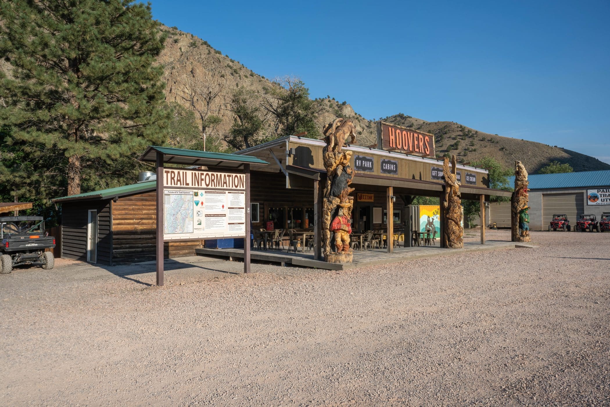
Hoovers is actually a Utah Highway Reststop with nice, well-maintained restrooms, drinking water, and picnic tables. There is room to park and unload at this location, so consider having lunch here if Hoovers and Big Rock Cafe are open. Beyond these establishments, you’ll need to...

The Beaver Main Street Trailhead is located on the Southeast corner of Main Street and 600 North in Beaver City, Utah. The Beaver/Tushar loop is a 48-mile, 50” ride through the Tushar Mountains. ...

Rich in history, this beautiful creek-side trail was once an area where many came to seek fame and fortune by mining for gold. Pamphlets detailing various historic sites are usually available at the sign-in station near the intersection of Pine Creek Road and PST #77. ...

Finding the trailhead is a bit of a stretch, so pay attention. The Circleville Trailhead is located at the entrance to the City Cemetery, which is on the northwest corner of town. It’s a little less than a mile north of the big turn-off on...